Date: 1/02/2026
River: Ashley River, Canterbury, NZ
River Conditions: 11 cumecs at Ashley Gorge. Water clear. Grade 3.
Weather Conditions: Sunny and warm, light NE winds..
Number on Trip: 3.
Time on River: 3.25 hours.
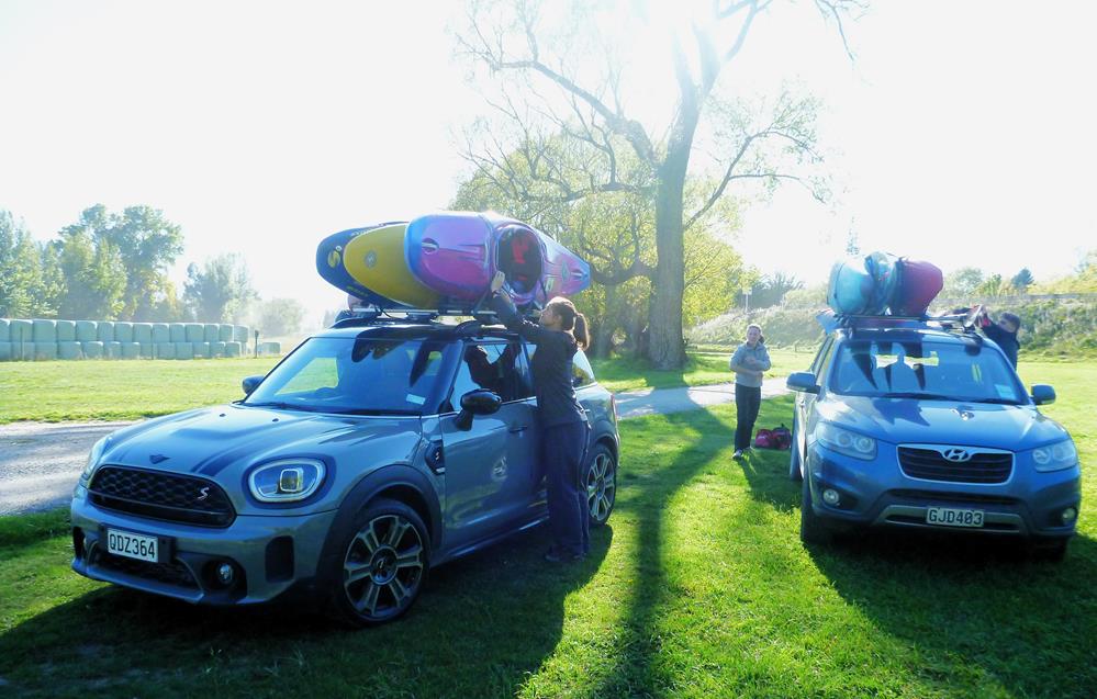
Comments: I had planned to head up to the Hurunui, but when John R suggested paddling the Ashley it didn’t require much deliberation to change my mind. The later leaving time, reduced travel times and the opportunity to paddle the Ashley again ticked all the boxes. Having not paddled the lower section of the Ashley since 2021, I was pretty excited and just a little nervous as I hadn’t paddled grade 3 rapids in over 5 years as the pandemic really put the brakes on my social outings. Together with Bill, the three of us met up at the Belfast Tavern, John loaded his kayak on to Bill’s car, while I drove off to the campground as I don’t drive particularly fast and needed the head start. I’d only started to get changed into my paddling gear when the others arrived, apologising for the delay having missed the turn off and ended up going through Rangiora, so it was lucky I did have some lead time.
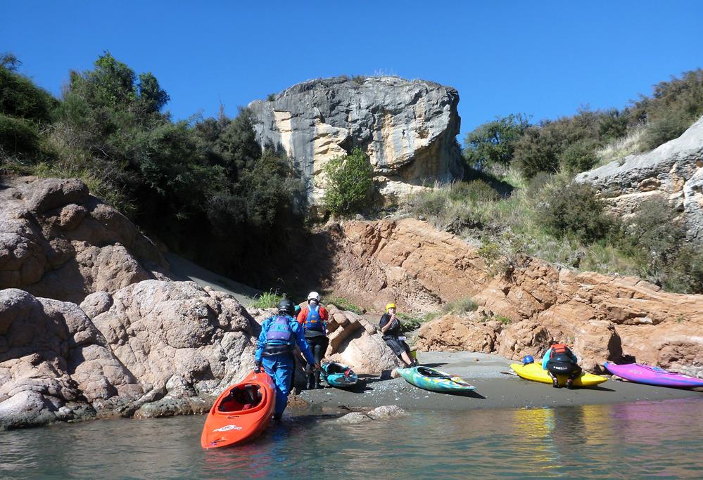
With my Blitz loaded on Bill’s roof rack, we drove to the put in at the middle bridge. The road was pretty rough with a lot of pot holes and loose rocks, I suspect the weather has taken its’ toll on the surface. We put in at the middle bridge and made our way downstream.
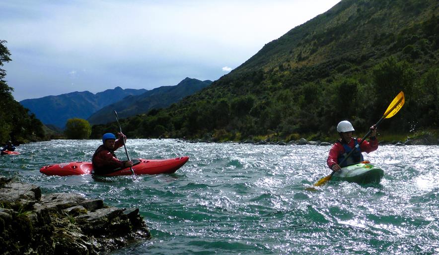
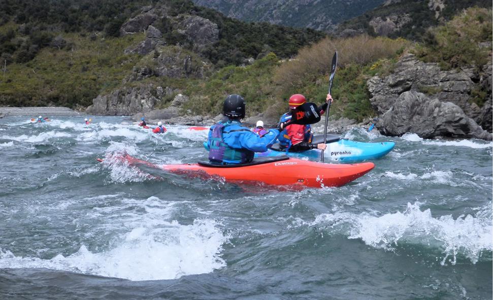
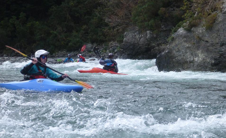
We kept up a reasonable pace but still managed to get some play in. Even with a relatively low flow, the rapids still offered a reasonable challenge, and some of the features are even better with less water, though you do have to watch for rocks, as some will be very close to the surface. Charging though all the white water without a care, will probably result in the occasional crash or upset.
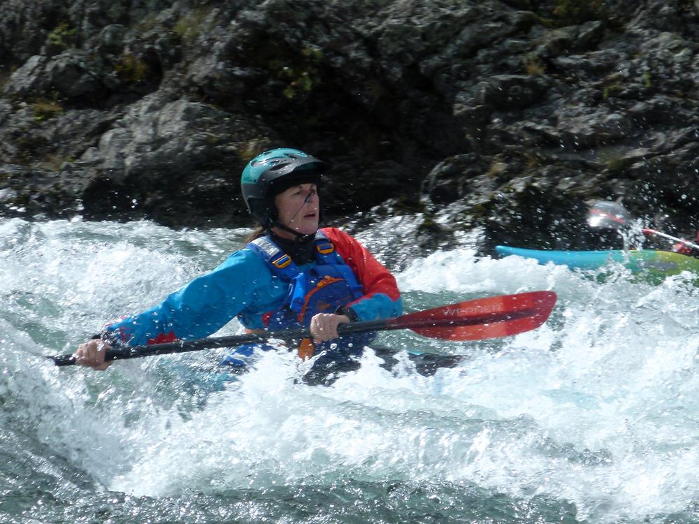
It was a beautiful day and it was great to be on the river. I was still a bit nervous but I gradually began to feel more confidant as we went on. It is always nice to discover that you still remember how to paddle.
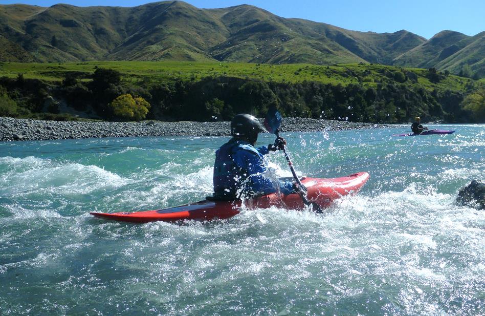
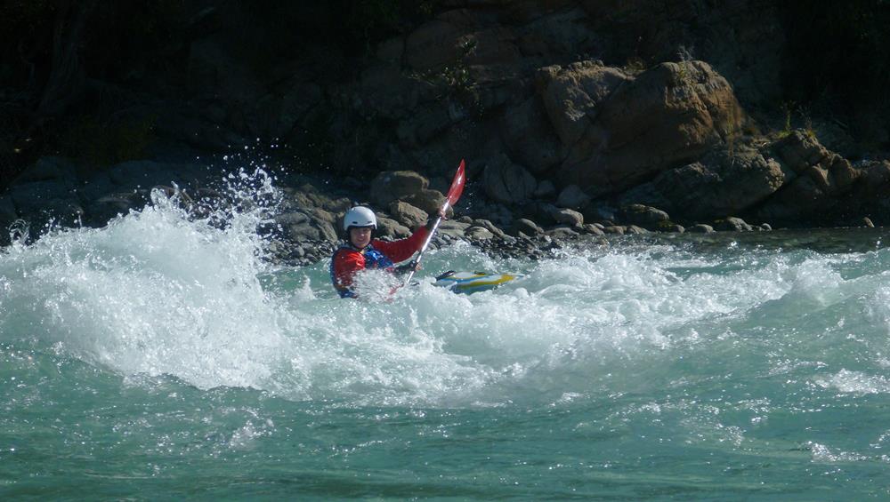
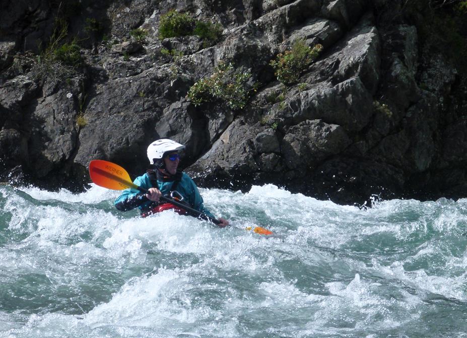
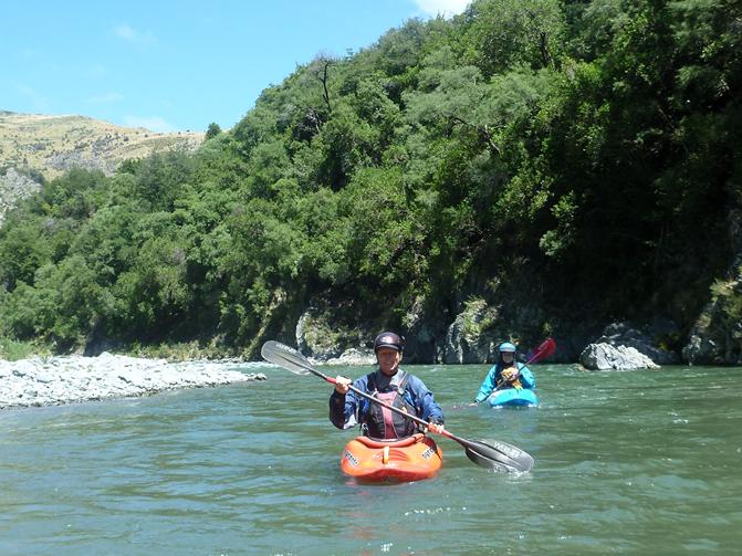
John demonstrated some impressive skills, surfing and doing tricks, which was even more impressive when John pointed out he is now well over 70! He is one of the old hands who was a stalwart of the club when I first joined, and most of the others no longer paddle.
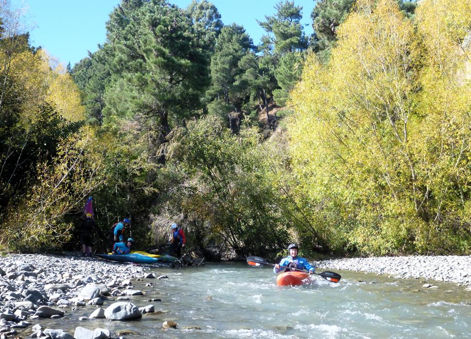
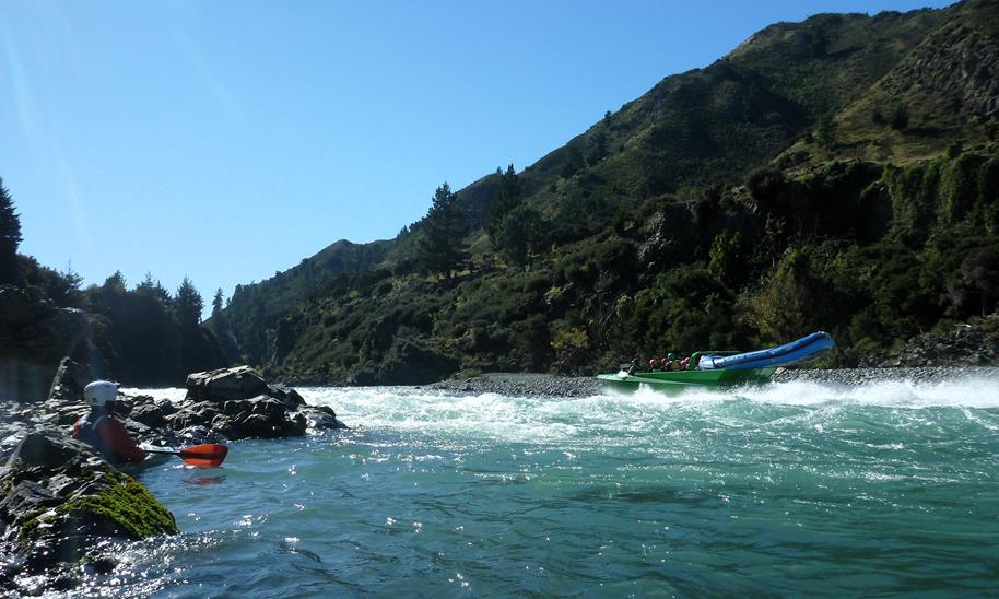
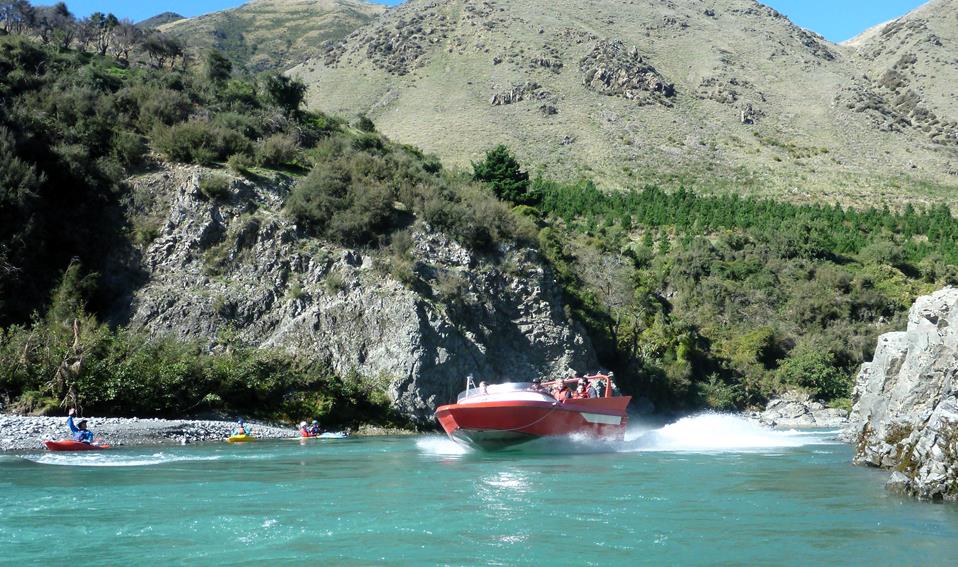
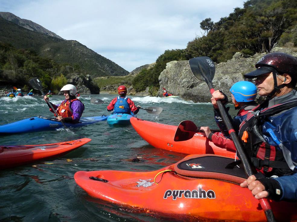
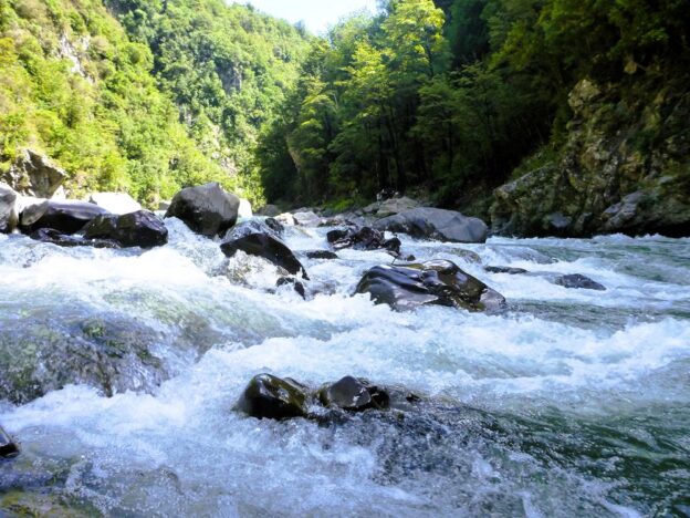
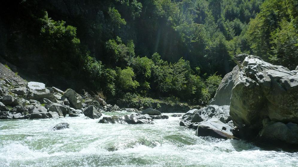
As we were setting a fairly brisk, I didn’t take that many photos, however I did want to take some photos of water, rapids and general scenery for another project, so I have a number of pictures without kayakers.
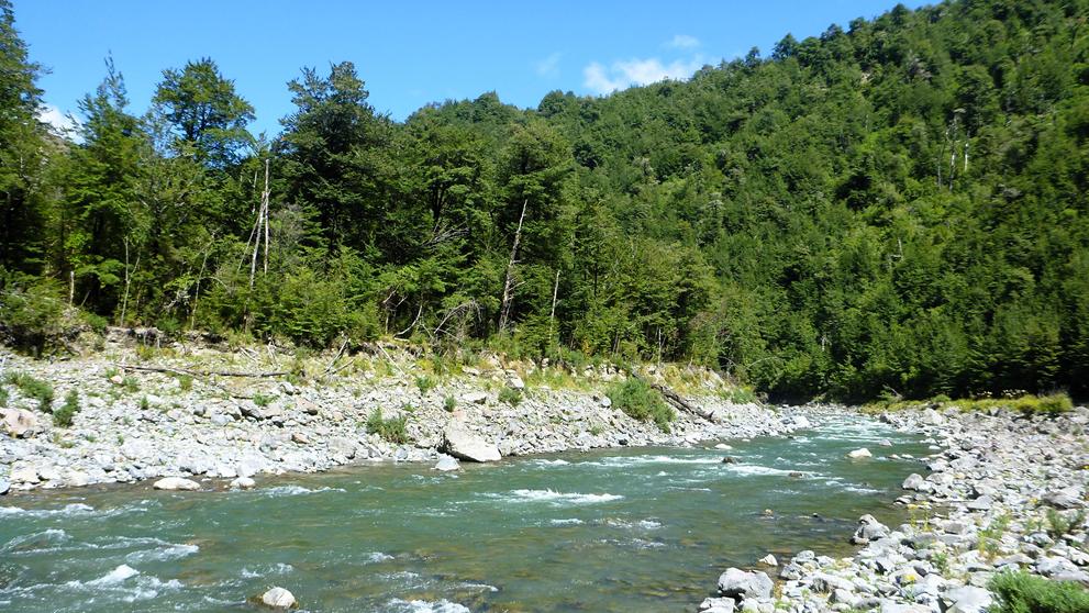
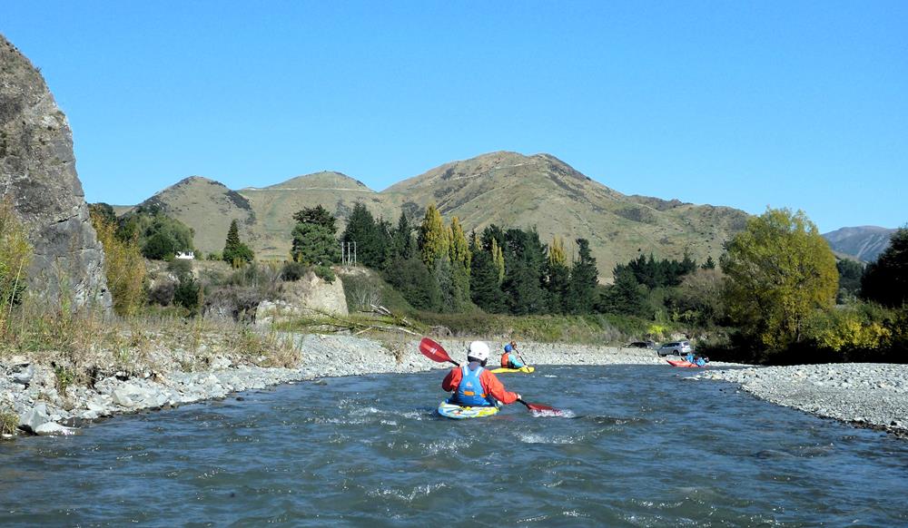
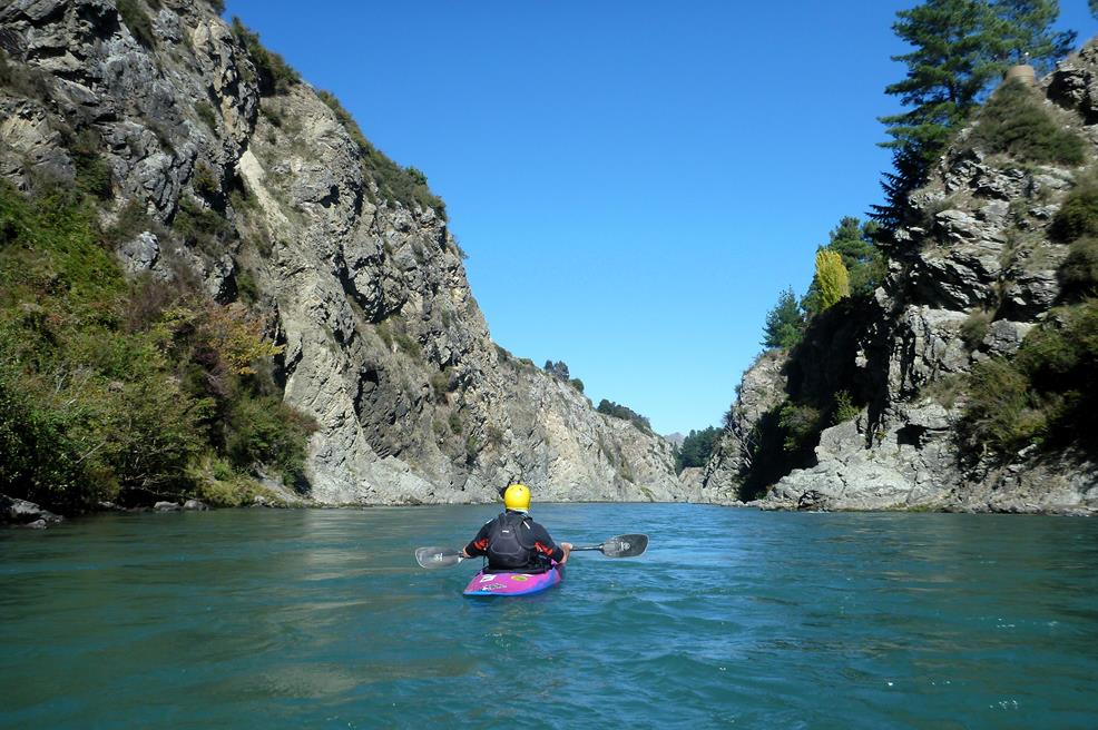
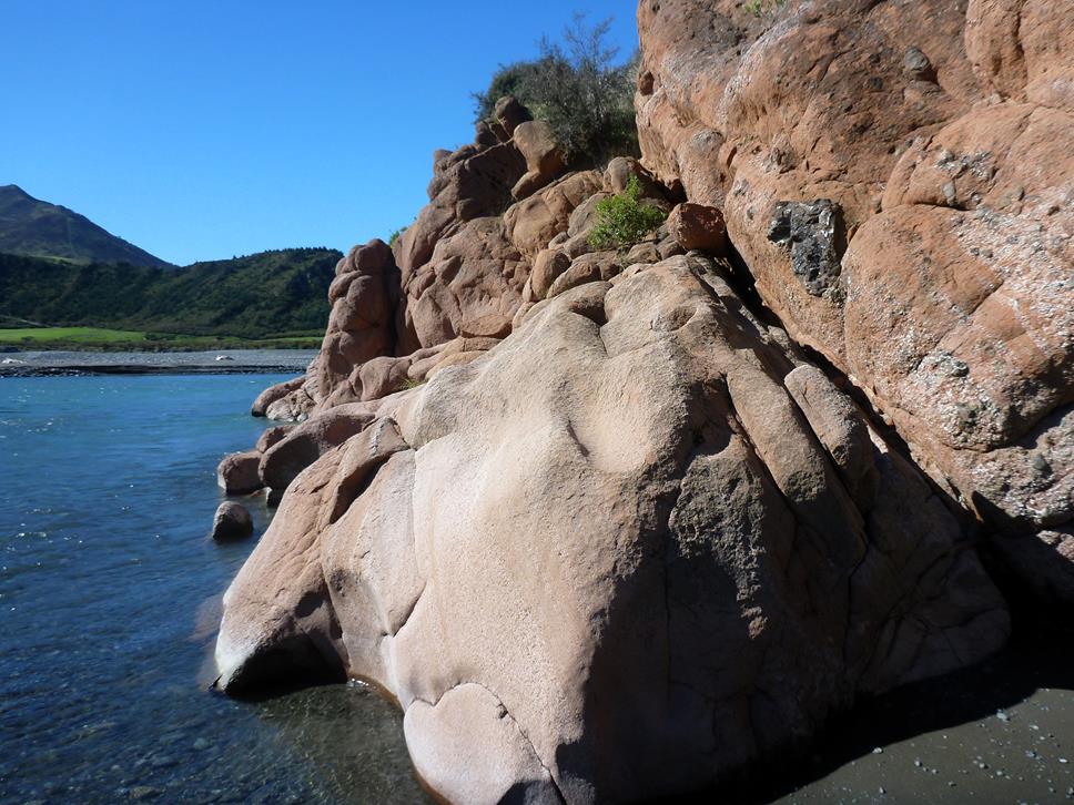
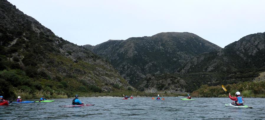
Hopefully these images capture the beauty of the Ashley River and the excitement of whitewater. The scenery and natural wonder is one of the highlights of this particular run, and always make it worth doing if you have the opportunity, especially as it is so close to the city but still has a definite wilderness feel.
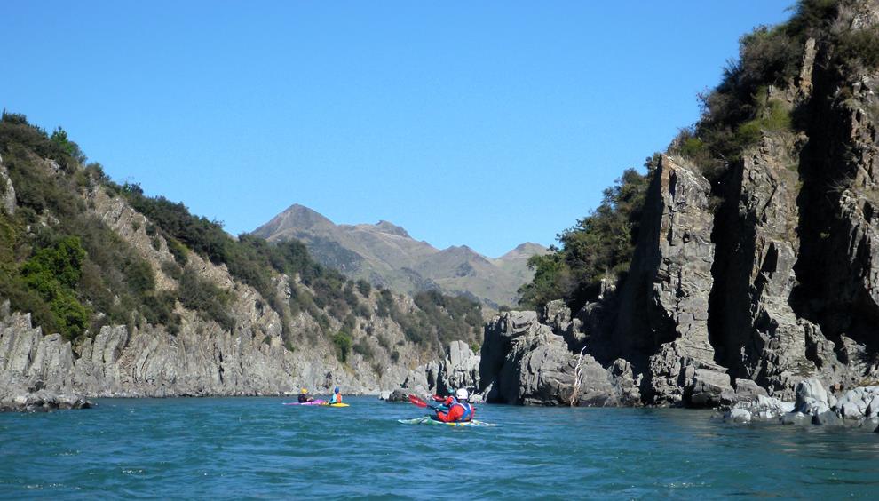
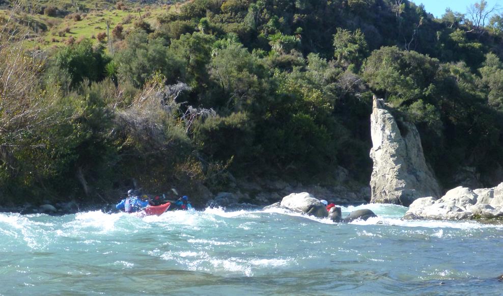
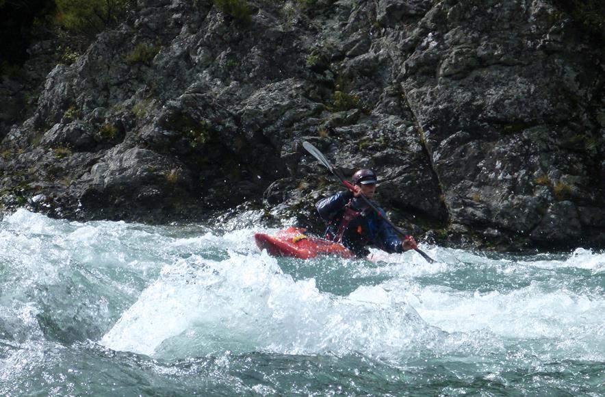
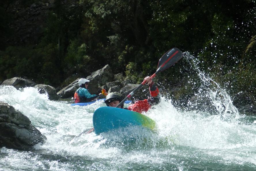
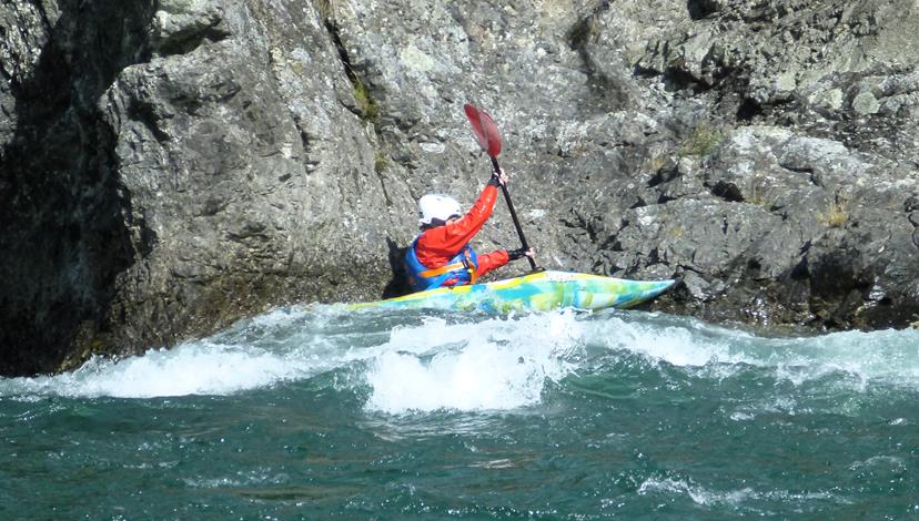
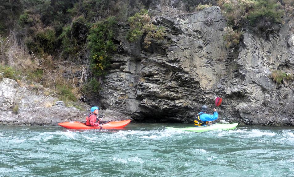
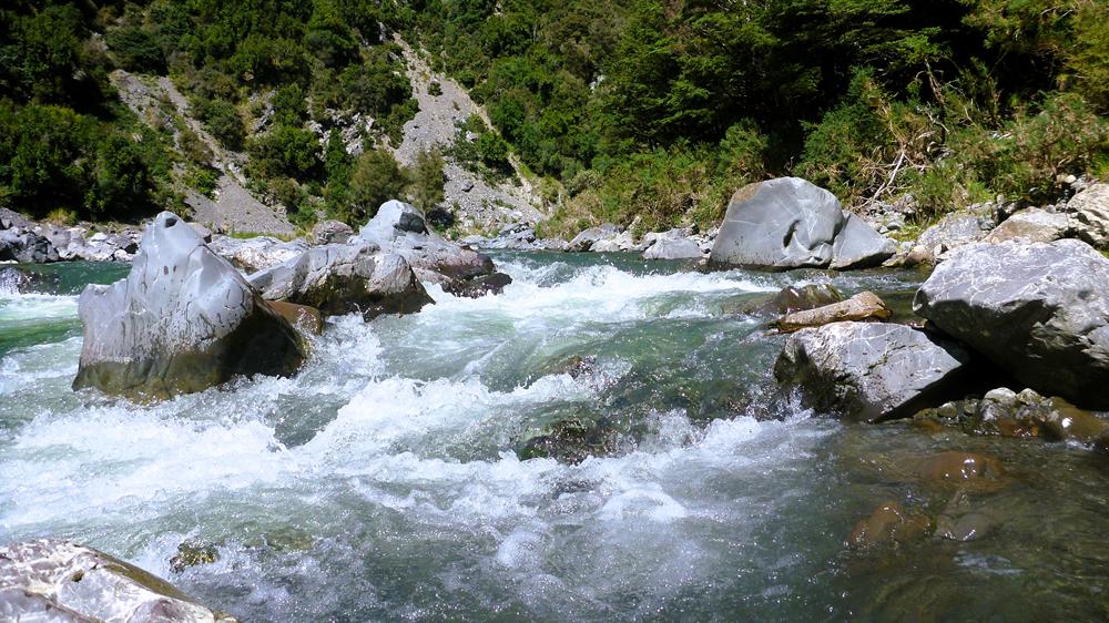
Once in the gorge proper, the walls close in and the rapids get a little harder and more closely spaced. With the lower flow, the rapids aren’t as pushy but you definitely want stay alert and keep an eye out for rocks that can trip you up, making things a little more exciting.
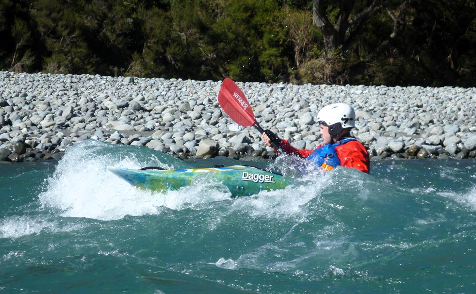
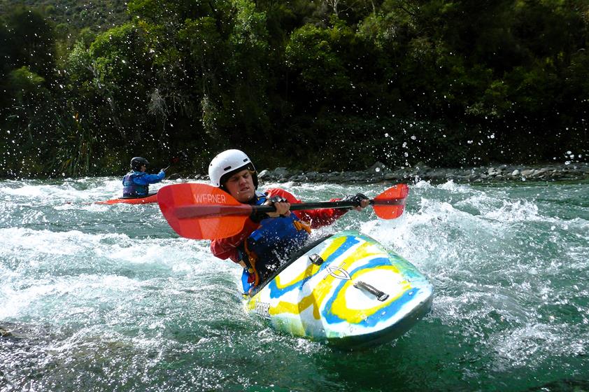
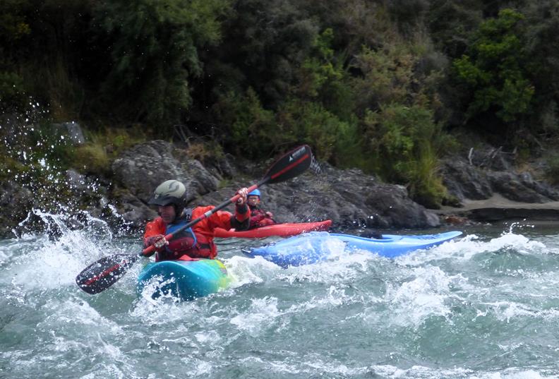
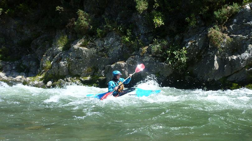
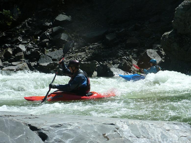
There were some good play spots and John certainly makes it look easy.
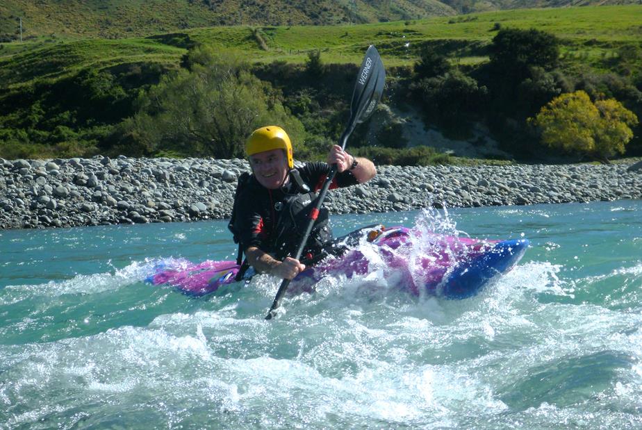
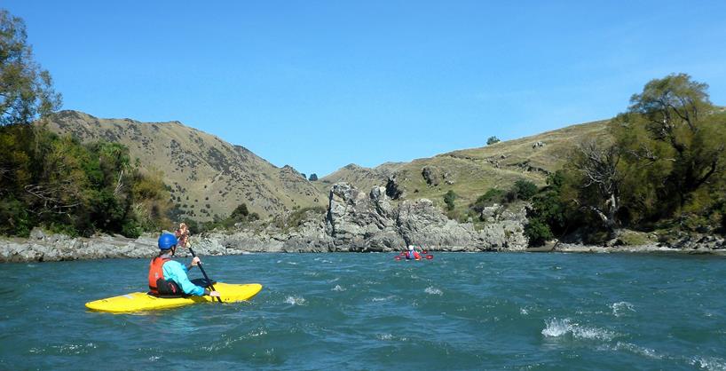
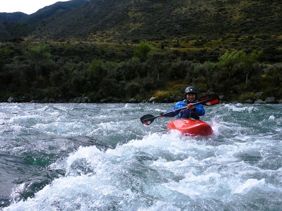
Bill also got some good surfs in and by his smile, he certainly looked like he was having fun, and on a beautiful sunny day when there’s water in the Ashley, could there be a better place to be?
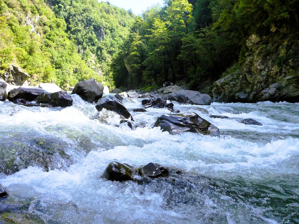
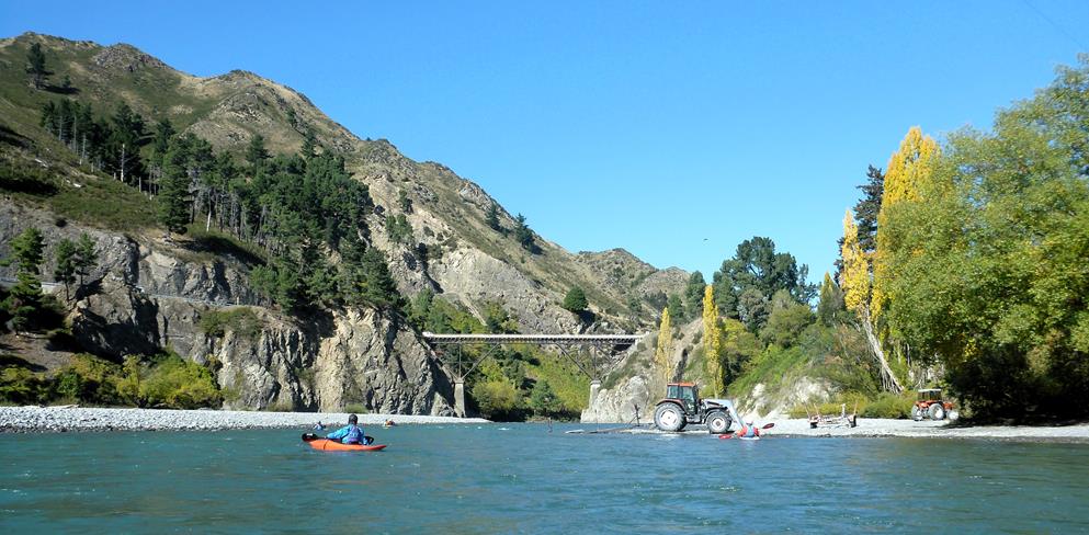
The blend of colours and textures make photography in the gorge look amazing, the green of the vegetation and deep water, whitewater and bubbles, the sheen and curves of wet rocks, just wonderful. It was great to be able to capture these images, as often the light levels are too low to get good photos, or sometimes too misty, and water spots on the lens are often an issue.
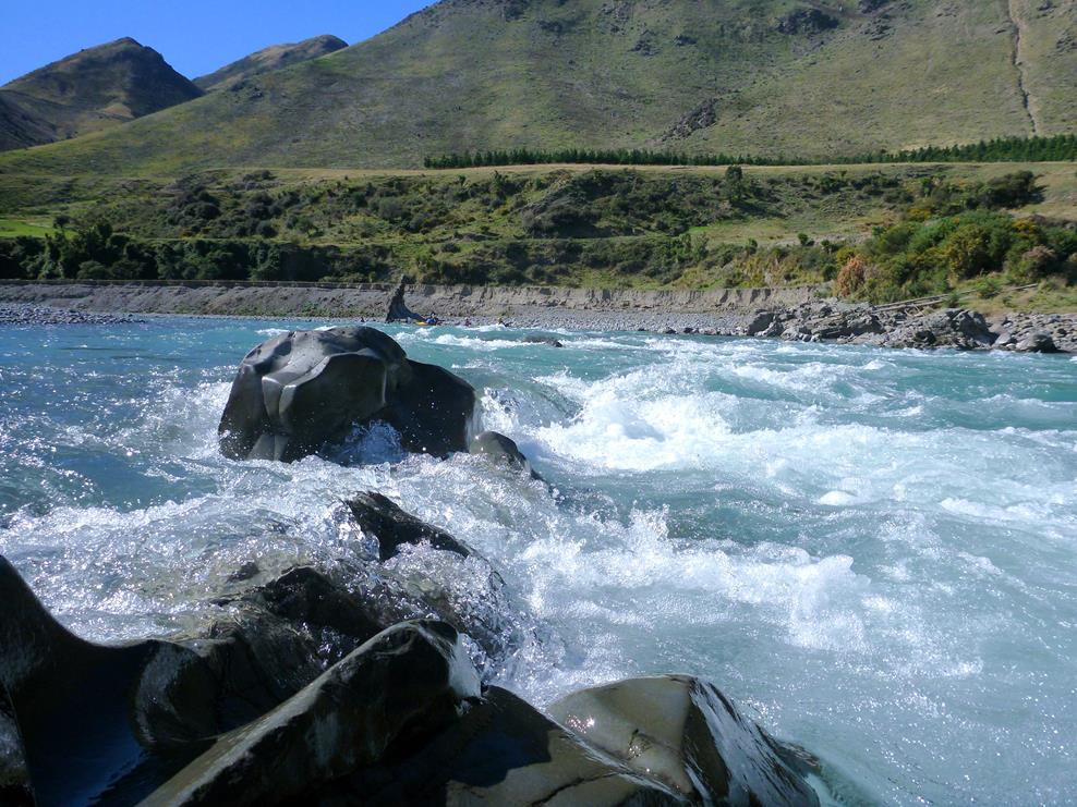
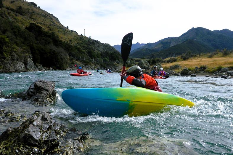
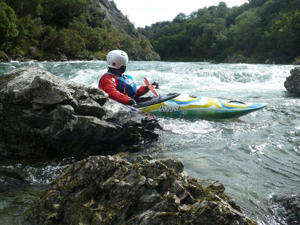
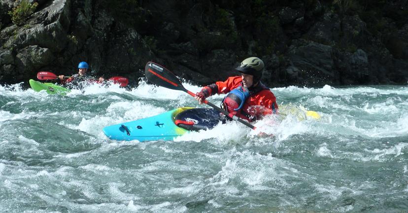
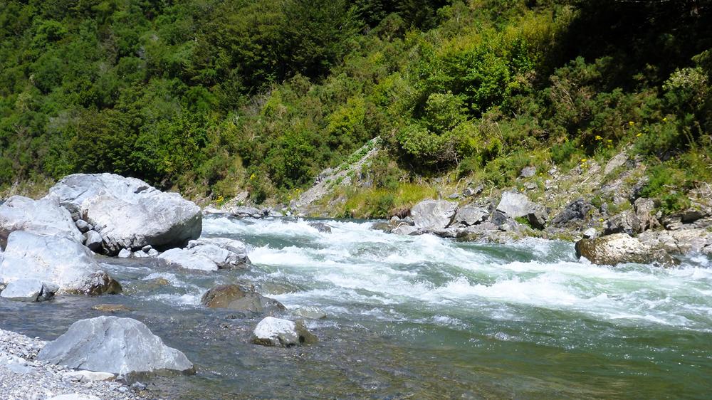
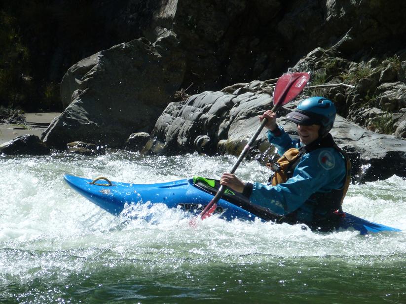
It is a great place and it was nice to reacquaint myself to the various rapids, refresh my memory and see watch has changed. I scarcely recognised the approach to the main drop, but I did appreciate John’s hand signal indicating the line, and I managed to run the rapid without drama, cutting into the eddy below so I could get a good photo.
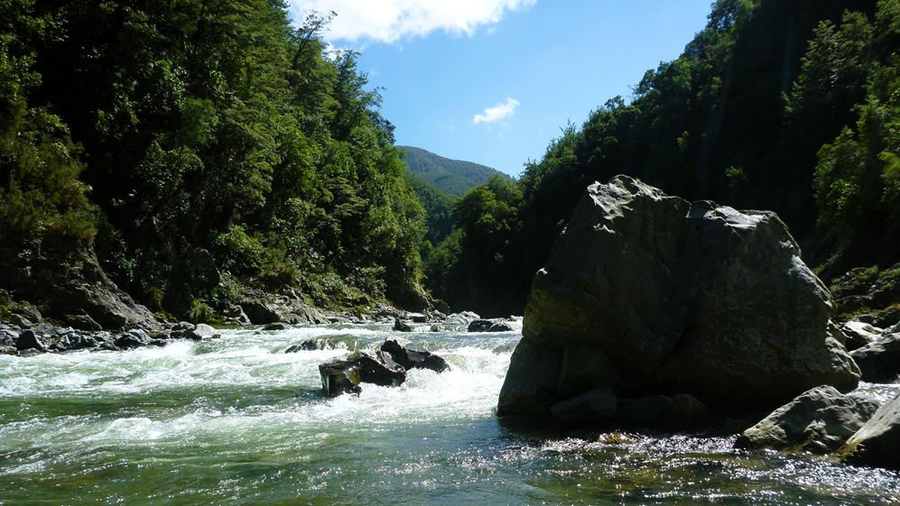
The main drop has changed over the years and isn’t quite as challenging as it used to be, more a rapid than a drop as can be seen in the above photo. Unfortunately the above photo ended up with a water spot over the big rock on the left and a lot of lens flare, which was pretty annoying. I usually check the lens after taking pictures to make sure there is no water on the lens, and then take additional photos if I think there was an issue. I was disappointed when I went through the photos later and found I only had the one shot and that was “ruined”, fortunately I was able to fix the picture using ChatGPT and the result was quite impressive.
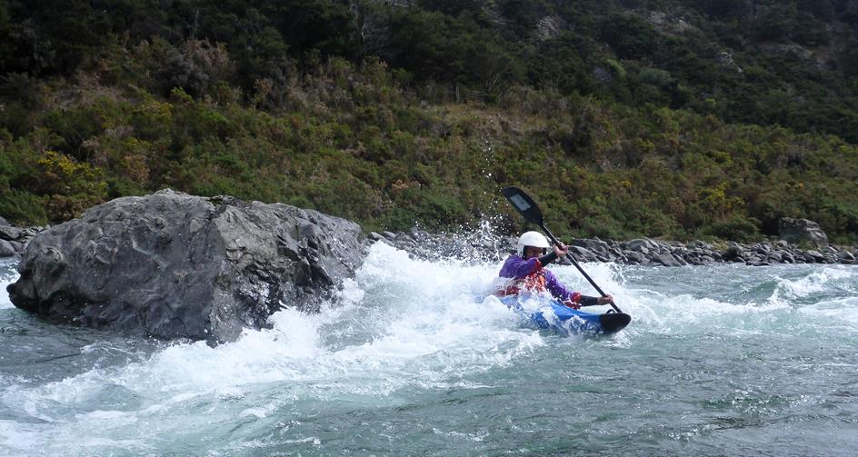
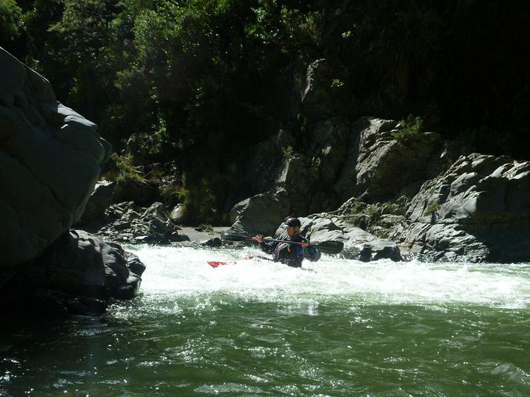
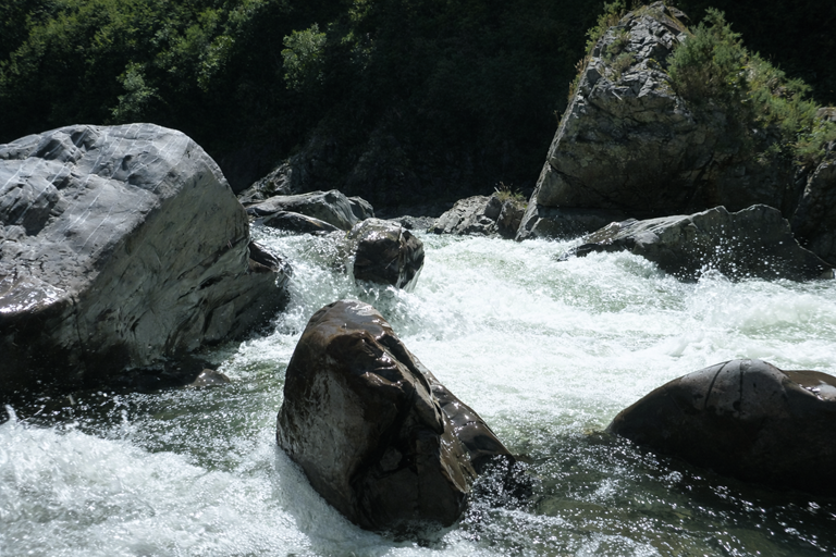
Three trick rapid has continued to evolve since the big rockfall in 2022, so it is worth having a look from above to make sure you can see a line through the rocks. We carefully picked our way down and didn’t have any issues but there is definitely the potential for the odd surprise lurking there.
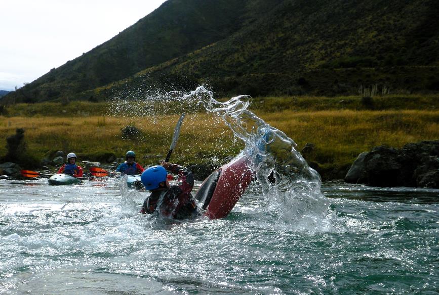
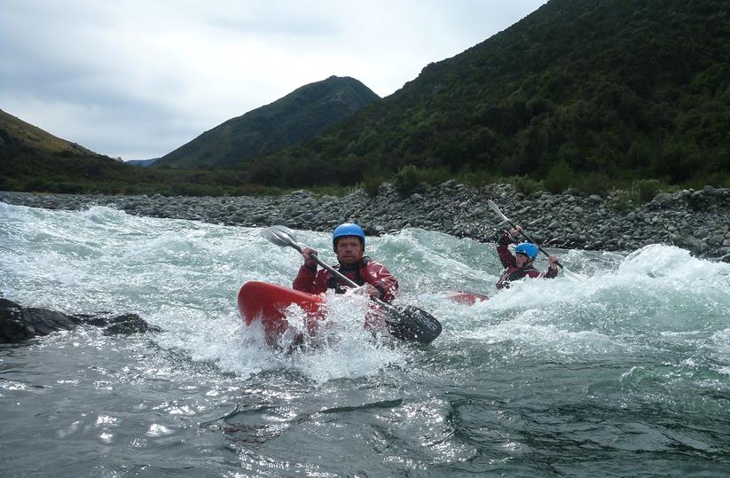
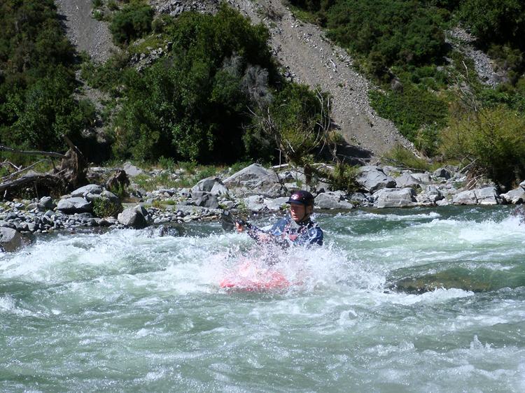
The last grade 3 rapid was a little trickier at this flow with much of the flow pushing in to the massive rock that guards the right-hand channel through. John had no issues, but Bill got a little too close and found himself pushed against it and tipped over. He didn’t quite manage to roll and bailed out as he got swept through the right-hand gap, John was on hand to assist with the recovery in the pool below the rapid. I made some mental notes and endeavoured to keep right, avoid the rocks above and stay well away from the base of the massive rock, it seemed to work and I soon caught up with the others.
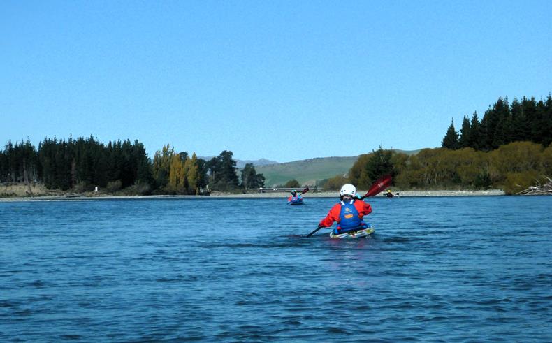
After the last major rapid, the paddle out is a chance to have a more relaxing and fun paddle while enjoying the scenery as you float by. There are still plenty of rapids and places to surf, and even with only 11 cumecs, the river doesn’t get too shallow to paddle. John had been trying to encourage me to do a practice roll, something I don’t often do as I prefer to stay upright and keep dry, but after we passed the river level gauge, I thought I may as well give it a try. We found a spot that seemed deep enough and I tipped over, the next thing I know, my helmet is rattling along the gravel bottom and the water is too shallow to set up for a roll. I pull the deck and dragged my boat to a spot where I was able to empty the water out and get back in, not exactly a successful roll, oh well maybe next time.
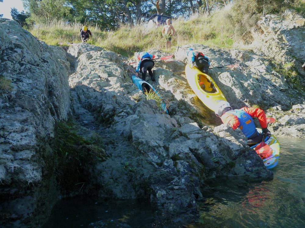
We paddled on down to the campground to find plenty of swimmers enjoying the river on a warm summers day. Got changed, loaded my boat on my car and drove Bill back to the put in. I let him get away first so he wasn’t stuck behind me slowly driving out and then headed for home. A brief stop in Oxford for a well earned ice cream and then home, tired but pleased to have got out. Lauri was pleased to see me home at a decent time as well.